
1918 US Army Map to Illustrate the Meuse-Argonne Offensive ~ World War I ~ Western Front ~ France ~ daily lines of advance
$270.00
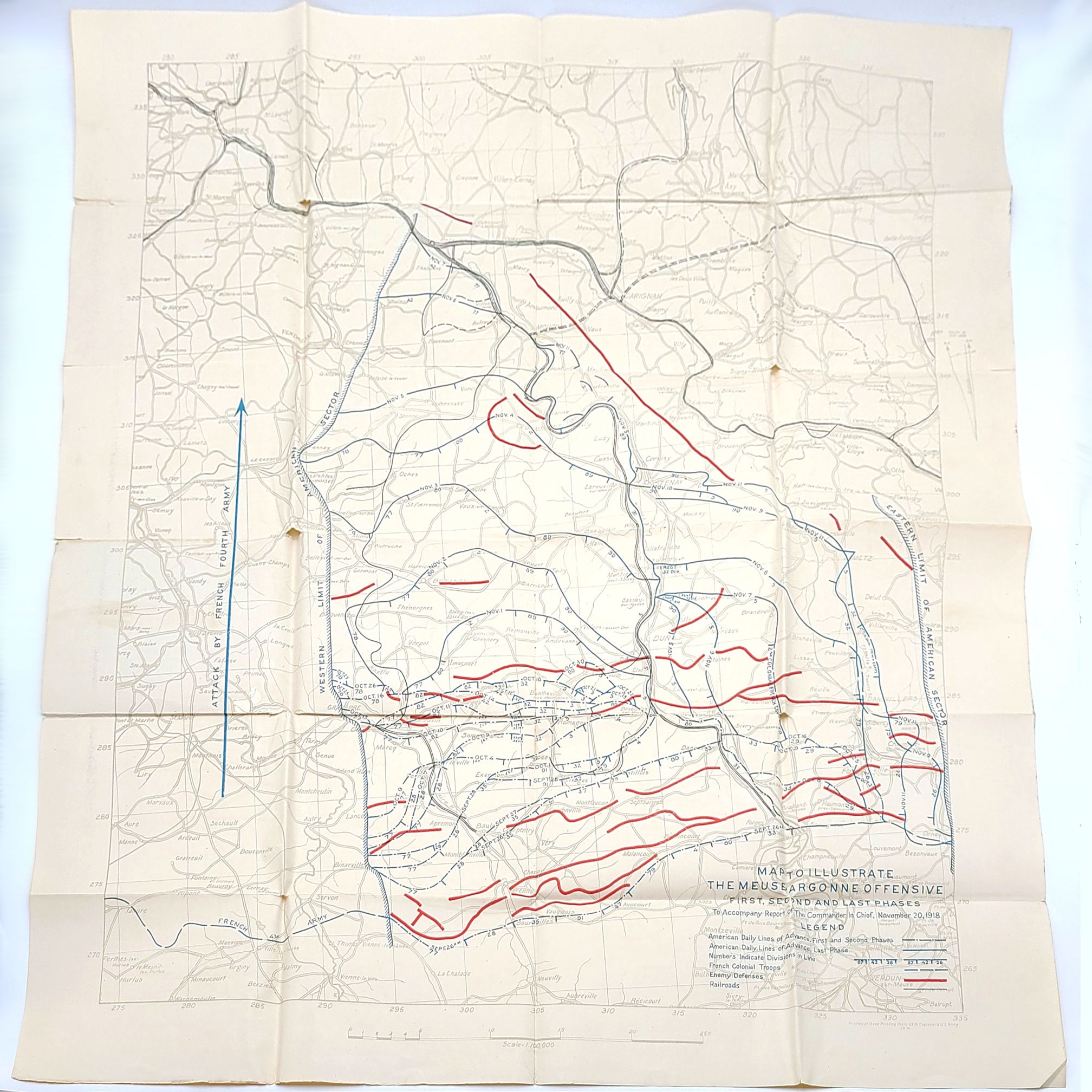
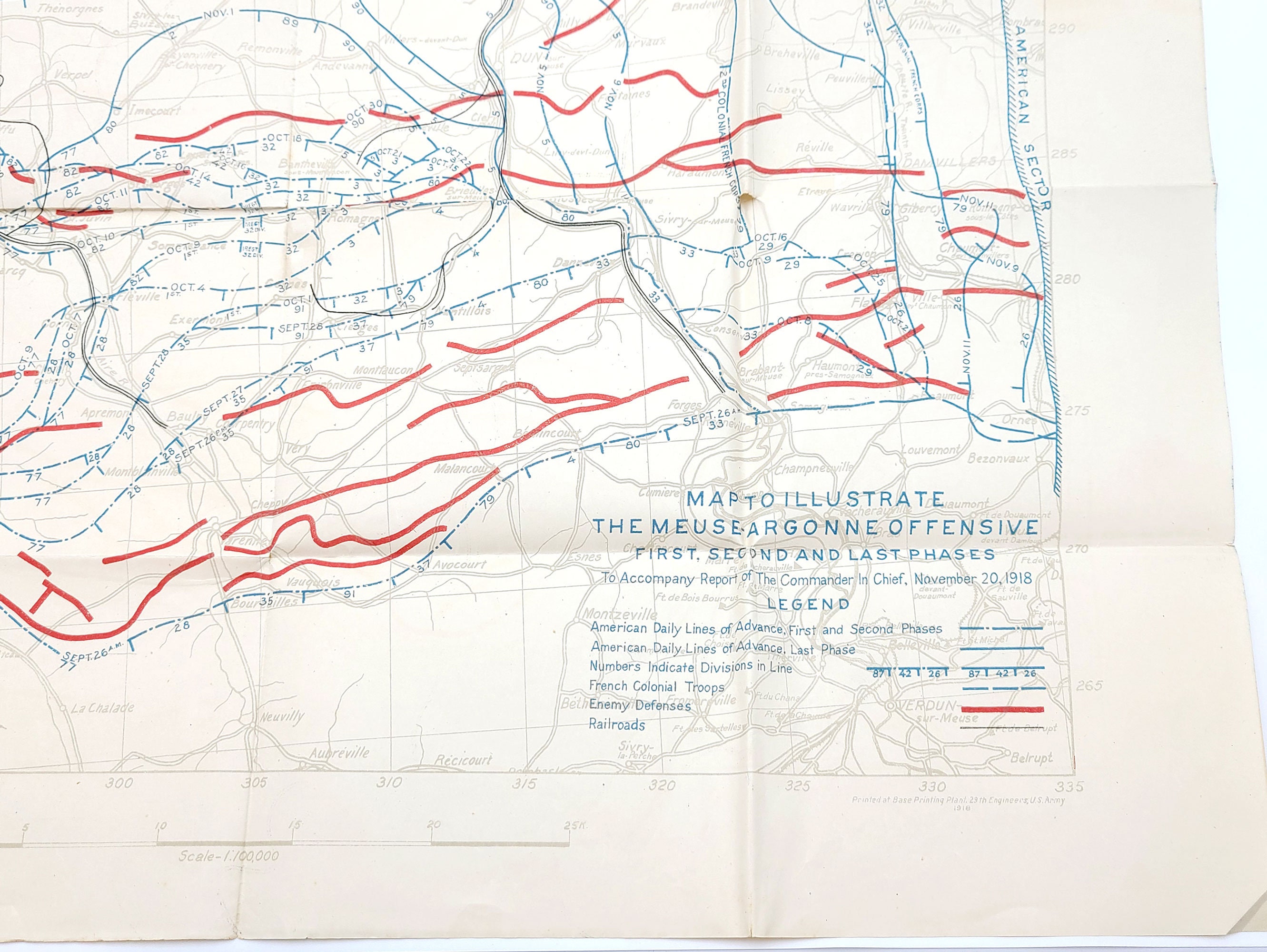
Item: Map to Illustrate the Meuse-Argonne Offensive First, Second and Last Phases: To Accompany Report of The Commander In Chief, November 20, 1918
Description: November 1918 map of the Meuse-Argonne Offensive, printed by the U.S. Army. 31.8 x 29 inches. Map is clean. No chips, but does have short tears at fold junctions (where vertical and horizontal folds intersect) and a few short closed edge tears at points of fold. 31.8 x 29 inches.
Map showing the American daily lines of advance for the first, second and third phases of the Meuse-Argonne Offensive. The lines segmented to indicate the place of each division along the line The lines of enemy defense, as well as those of the 2nd French Colonial Corps and the French 4th Army are also marked.
Published to accompany the Report of The Commander In Chief, November 20, 1918.
Condition: Good+
Place: Printed at Base Printing Plant, 29th Engineers, U.S. Army
Year: 1918
Keywords: World War I, WWI, France, Western Front,
Shipping from United States
Processing time
1 business day
Estimated shipping times
- North America : 3 - 5 business days
I'll do my best to meet these shipping estimates, but can't guarantee them. Actual delivery time will depend on the shipping method you choose.
Customs and import taxes
Buyers are responsible for any customs and import taxes that may apply. I'm not responsible for delays due to customs.
Payment Options
Returns & Exchanges
Returns & exchanges accepted within 30 days
Buyers are responsible for return shipping costs. If the item is not returned in its original condition, the buyer is responsible for any loss in value.
I gladly accept returns, exchanges, and cancellations
Request a cancellation within: 24 hours of purchase
Conditions of return
Buyers are responsible for return shipping costs. If the item is not returned in its original condition, the buyer is responsible for any loss in value.
Questions about your order?
Please contact me if you have any problems with your order.