
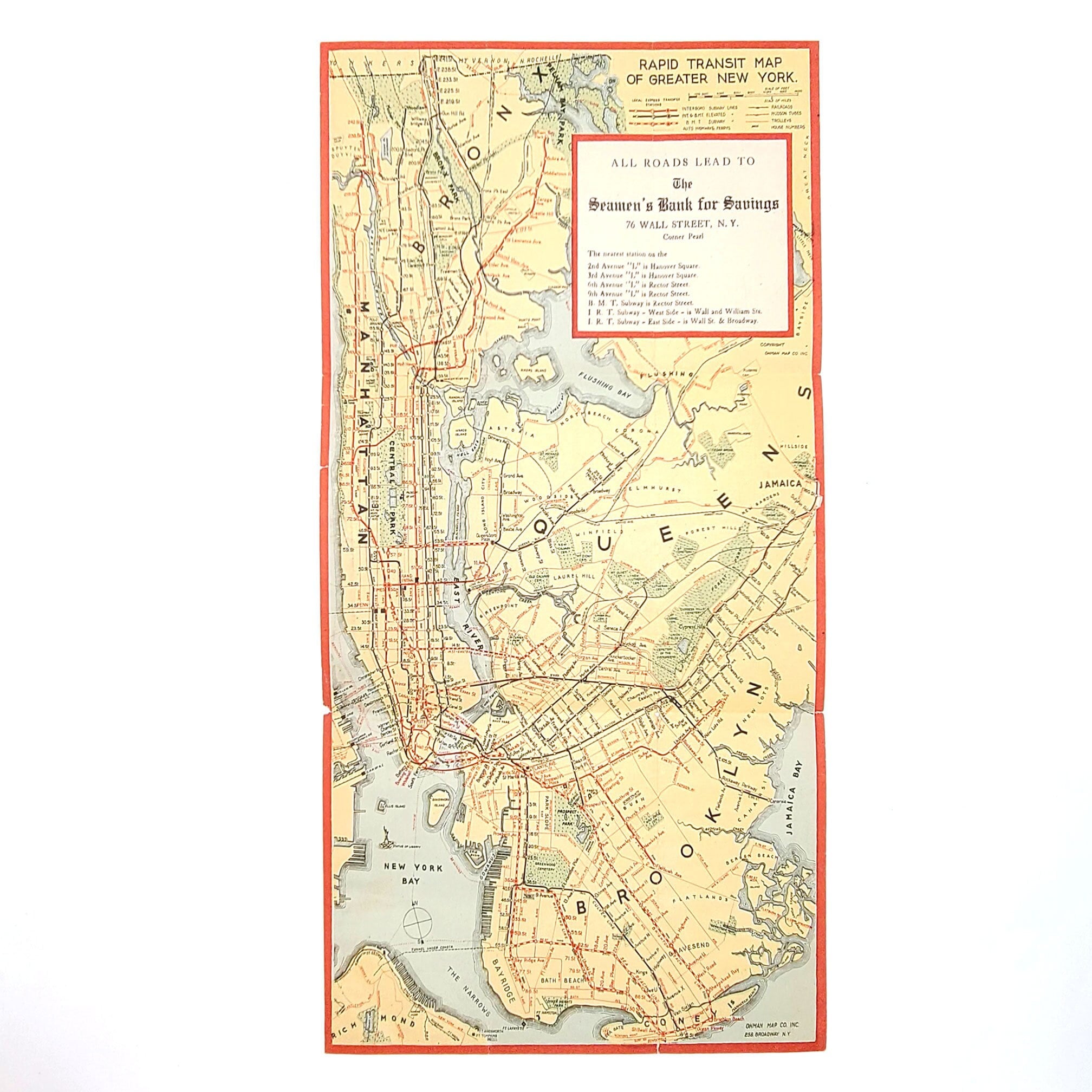
Rapid Transit Map of Greater New York [circa 1924] Ohman Map Co ~ subways, elevated lines, ferries, ~ interboro & Brooklyn-Manhattan Transit
$75.00
Item: [map] Rapid Transit Map of Greater New York
Description: Map measures approx. 15 x 9.5 inches. Small chip in the left margin, a couple other small tears at folds and two very small holes where folds intersect. Back side (blank) has some soiling and previous owner's name written on it.
The map (circa 1924) can be dated by the ''tunnel under construction,'' stretching between Staten Island (St. James) and Brooklyn (Bay Ridge). This Narrows Tunnel, which was also known as the Brooklyn-Richmond Freight & Passenger Tunnel, was never completed. The mayor broke ground for it in April 1923 and in 1925 the project was canceled, uncompleted.
The map shows interboro and Brooklyn-Manhattan Transit subway and elevated lines, highways, ferrys, railroads, Hudson Tubes, trolleys, and indicates periodical house numbers.
Condition: Very Good
Publisher: Ohman Map Co. Inc., 258 Broadway
Place: New York
Year: circa 1924
Keywords: Narrows Tunnel, Brooklyn-Richmond Tunnel,
Shipping from United States
Processing time
1 business day
Estimated shipping times
- North America : 3 - 5 business days
I'll do my best to meet these shipping estimates, but can't guarantee them. Actual delivery time will depend on the shipping method you choose.
Customs and import taxes
Buyers are responsible for any customs and import taxes that may apply. I'm not responsible for delays due to customs.