
1736 Beverley Patent map, Virginia, showing original grantees 1738-1815 in Orange County & Augusta County ~ Genealogy ~ Property/Land Owners
$35.00
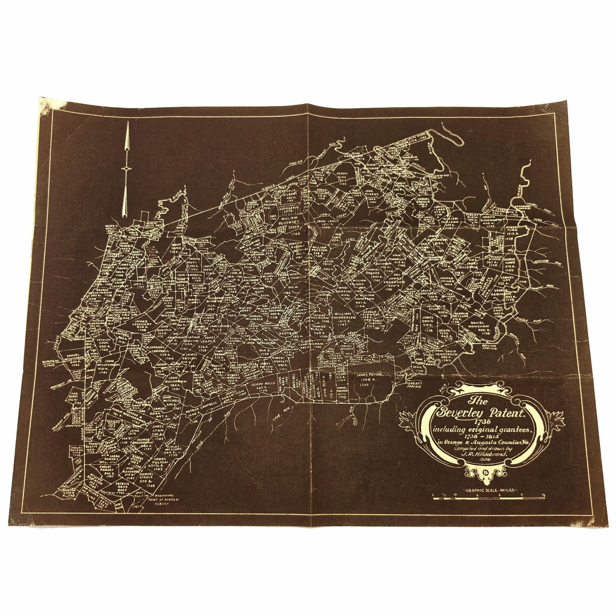
Title: The Beverley Patent. 1736 including original grantees, 1738-1815 in Orange & Augusta Counties, Va.
Author: compiled and drawn by J. R. [James Raymond] Hildebrand
Publication: [place of publisher not identified: publisher not identified], 1954
Description: Map showing the 18th century landowners of the Beverley Patent in Augusta County, Virginia (Orange County, Va.). It also shows drainage, the acreage of plots and the years they were acquired by their owners. 17 x 20 inches. Shows folds and general creasing from normal handling. Corners are abraded, showing some loss of surface (only affecting border areas). No pinholes. Previous owner's name rubber stamped on backside.
This map was drawn by James Raymond Hildebrand (1896-1980), a native of Augusta County, Virginia, and member of the Class of 1919 at Virginia Polytechnic Institute. He served the city of Roanoke first as assistant city engineer and then as the city’s first planning engineer. He was a noted map maker, whose work was based on his extensive research into land records and historical maps, particularly that of the 18th century settlement of the Upper Shenandoah, James, and Roanoke Rivers.
Condition: Good
Keywords: plat, map, property map, landowners, Orange County, Augusta County, Virginia, genealogy, history,
Shipping from United States
Processing time
1-2 business days
Estimated shipping times
- North America : 3 - 5 business days
I'll do my best to meet these shipping estimates, but can't guarantee them. Actual delivery time will depend on the shipping method you choose.
Customs and import taxes
Buyers are responsible for any customs and import taxes that may apply. I'm not responsible for delays due to customs.
Payment Options
Returns & Exchanges
Returns & exchanges accepted within 30 days
Buyers are responsible for return shipping costs. If the item is not returned in its original condition, the buyer is responsible for any loss in value.
I gladly accept returns, exchanges, and cancellations
Request a cancellation within: 24 hours of purchase
Conditions of return
Buyers are responsible for return shipping costs. If the item is not returned in its original condition, the buyer is responsible for any loss in value.
Questions about your order?
Please contact me if you have any problems with your order.